

STEM ROCK TRAIL
Ozark National Forest, Arkansas
Nestled deep in the hill country of north-central Arkansas, Stem Rock Natural Area is one of those places that feels almost hidden on purpose. Managed by the Arkansas Natural Heritage Commission, this preserve protects a rare geological formation, old-growth hardwoods, and an ecosystem shaped by centuries of wind, water, and wilderness.

THE BASICS
STEM ROCK TRAIL
Difficulty: Easy • Length: 1.4 Miles • Roundtrip Elevation: 91 ft
Pets: Pets are allowed on leash
Restrooms: There are no restroom facilities for this trail
Ideal time: Anytime of year would be great to check out Stem Rock Natural Area but winter leaf-off would provide the best views.
PLEASE PRACTICE THE SEVEN PRINCIPLES OF LEAVE NO TRACE: PLAN AHEAD, STAY ON THE TRAIL, PACK OUT WHAT YOU BRING TO THE HIKING TRAIL, PROPERLY DISPOSE OF WASTE, LEAVE AREAS AS YOU FOUND THEM, MINIMIZE CAMPFIRE IMPACTS, BE CONSIDERATE OF OTHER HIKERS, AND DO NOT APPROACH OR FEED WILDLIFE.

Stem Rock viewed from the opening of the “tunnel” cave.
GETTING TO THE STEM ROCK TRAIL
From Leslie, drive 7 miles on Hwy 66 to Oxley. Turn right onto Oxley Rd. After 0.3 miles, stay right on Oxley Rd. Drive 0.9 more miles. Look forthe parking area on the right with a small green signs for Stem Rock Natural Area.
PARKING GPS: 35.828551, -92.451720
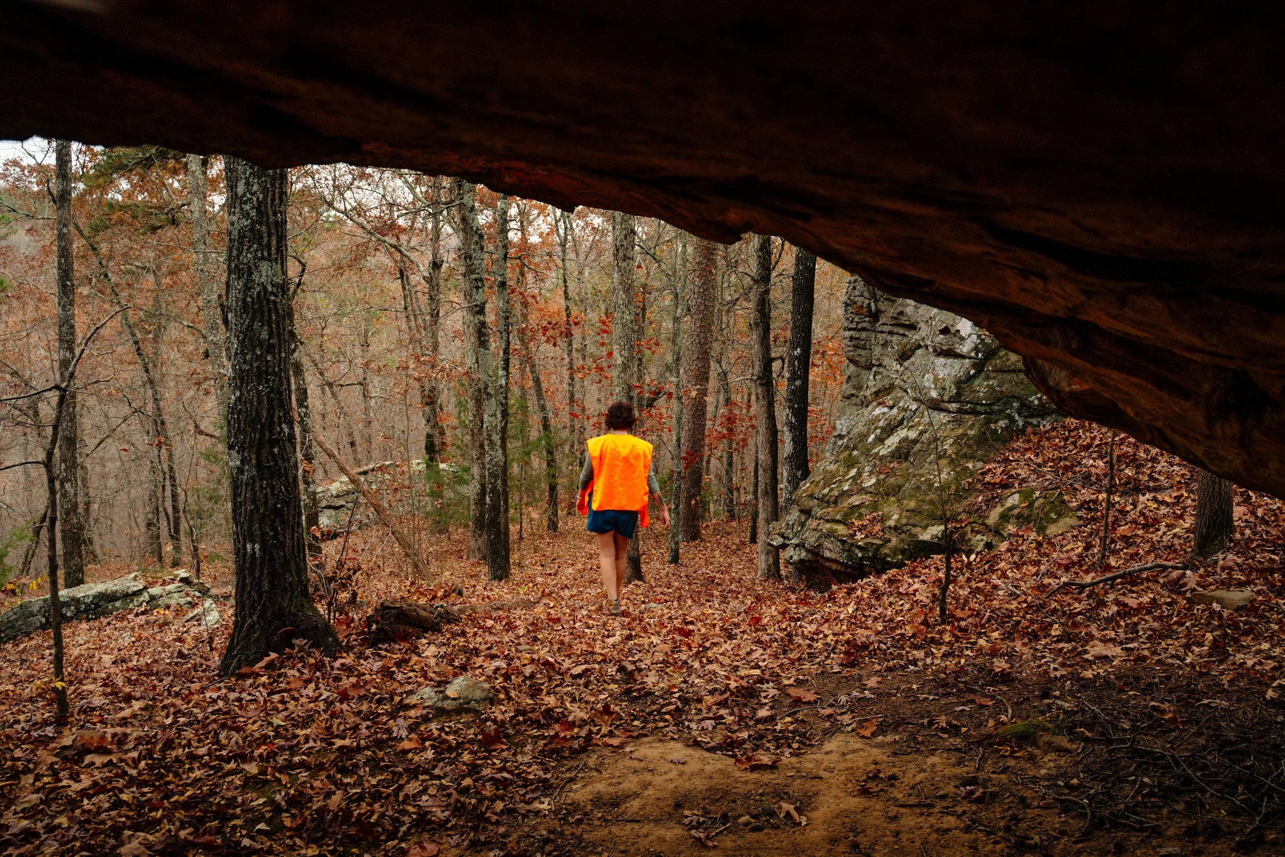
Hiking at the base of the formations.
Hiking at Stem Rock Natural Area is easy and convenient. The trail is well-defined following an old ATV road and easy to follow, so you don’t need a map or GPS. It’s a short walk with little elevation gain (1.5-mile round-trip trail to Stem Rock and back). The flat, gentle trail is great for all skill levels, with no steep hills. ATVs aren’t allowed, but mountain bikes are can be used on the trail!

The top of the formations resemble the Buzzard Roost Area
Once you reach the rock formations, you have a couple option for routes to explore. The formations have three levels, each with a different view and feel. At first, it might be hard to find your way between them, but if you look carefully, you’ll see the paths. From the top, look to the far right side of the bluffs to reach the second level. To go down to the third level (the base of the formations), go to the far left side. There’s a faint path there that brings you down to a small cave. There were a bunch of fallen leaves during our visit and it was a bit slippery so use caution even on this small incline. At the lowest level, you can walk around the base of the rocks or explore a tunnel like cave between the formations and the main bluff.
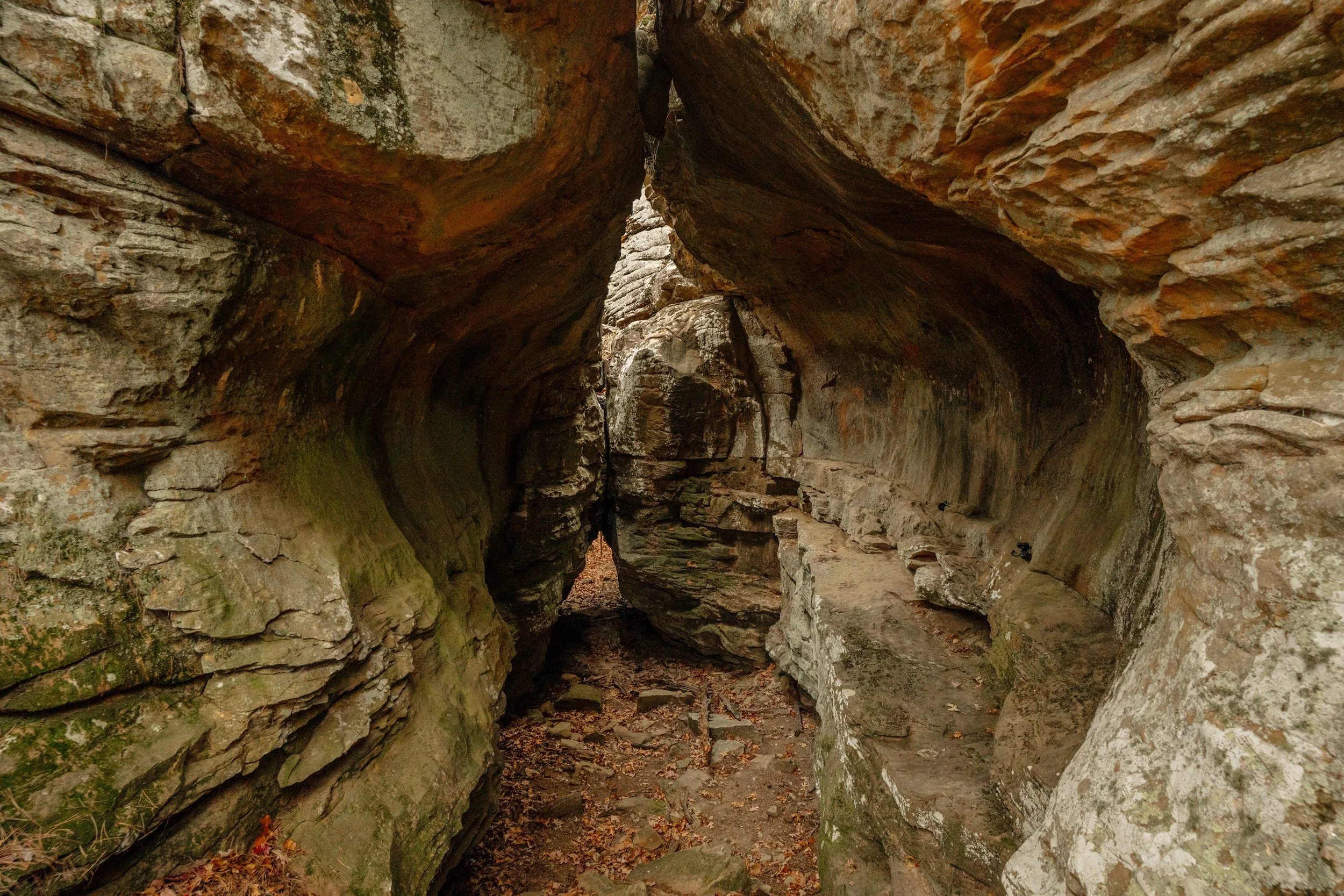
The “tunnel” Cave is unique and even has a nice sitting area shelf on the right side.
The star of the natural area is—no surprise—Stem Rock itself: a beautiful pedestal-shaped sandstone formation rising from the forest floor like a giant mushroom or stone tree trunk. Over millions of years, water and weather carved away the softer rock below, leaving behind a narrow “stem” supporting a broad, flat cap.
It very reminiscent of the pedestals you find at Pedestal Rocks Scenic Area nearly 60 miles away, and the area kind of feels like like a miniature version of that scenic area.

The Stem Rock with MC for scale.

Taking in the sunset from the top of the formations.
WHAT TO BRING FOR YOUR Stem rock HIKE
To stay safe and get the most out of your adventure, here are some essential items to pack:
Wear sturdy hiking shoes — the sandstone can be slick when damp.
Pack a wide-angle lens if you’re photographing; the formation is huge up close.
Water and snacks – even for a short hike, because you never know.
Weather-appropriate layers – Conditions can change quickly. Bring a lightweight rain jacket if the forecast looks questionable.
Small first aid kit – Blisters, scrape, sting and bites can happen—better to be prepared.
Stem Rock Fine Art Prints are available HERE
